Updated on November 11, 2024 by Julie McCool
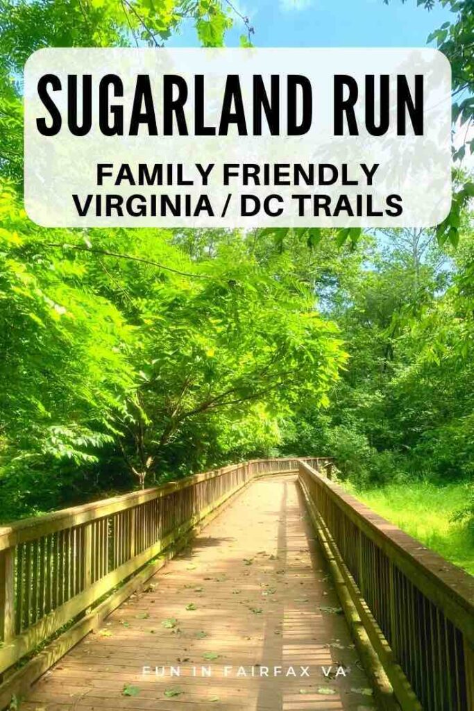
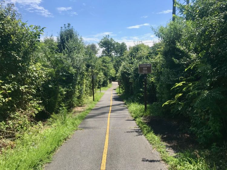
Enjoy a shady Sugarland Run hike or bike outing on a paved stream-side trail in Reston and Herndon Virginia. The 4-mile trail borders a small stream called Sugarland Run, offering a nice walk with pretty water views. Many access points from neighborhood streets make it easy to break this hike into sections and adjust the length of your outing.
We are always looking for family-friendly parks and trails to enjoy the outdoors close to home. The Sugarland Run trail is perfect for fitness buffs, families, dog-walkers, and bike riders who want some exercise without a long drive to the countryside.
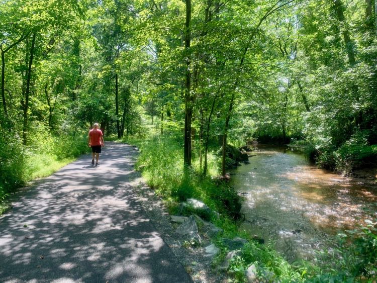
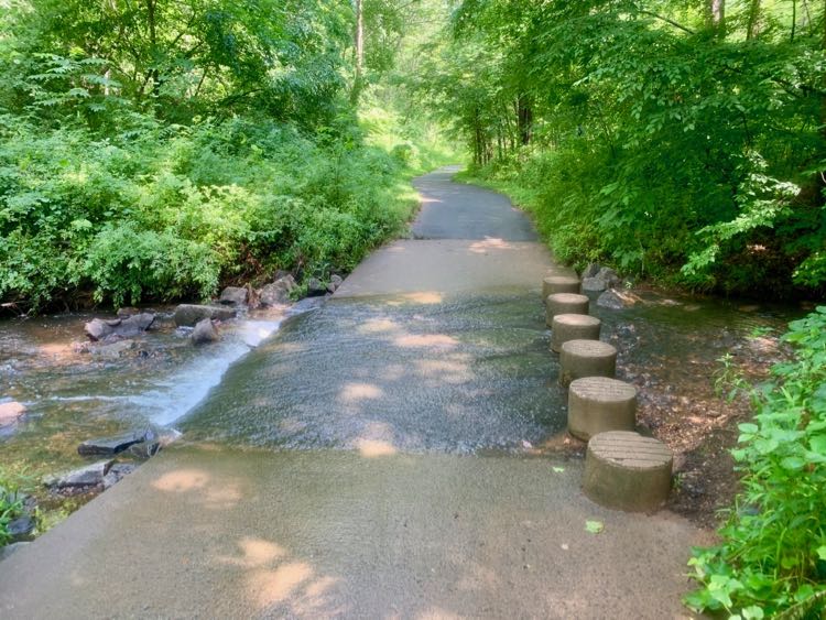
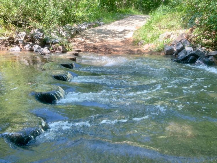
The entire 4-mile Sugarland Run trail is paved and is mostly level. Sections of the trail are wheelchair accessible and stroller-friendly. However, there are several fair-weather stream crossings that use concrete pillars to cross Sugarland Run.
While the concrete columns are fun for adventurous kids, they are difficult or impossible to navigate for wheelchairs and people with mobility or balance issues. Below we highlight the best sections to hike if you want to avoid or include fair-weather crossings.
What to Expect on Stream Valley Trails in Northern VA
Steam valleys throughout Fairfax County provide a buffer between urban development and local wetlands. These buffers protect the Runs (a Run is a stream) that feed into local rivers and the Chesapeake Bay. Happily, you can explore many of these areas on paved and natural Stream Valley Trails.
We love the Stream Valley Trails in Northern Virginia.
- They’re close to urban developments so are easy to reach from DC and its suburbs.
- SVTs are usually wooded and shady, perfect for hot summer days and colorful fall foliage.
- Fairfax County maintains the trails, offering a safe and welcoming environment.
- They have many access points from surrounding neighborhoods.
- They are free to use and there is plenty of free parking nearby.
Sugarland Run Hike in Reston and Herndon VA
The Sugarland Run Stream Valley Trail is 4 miles long and is paved throughout. The entire trail is open to pedestrians, dog walkers, and cyclists. There is only one street crossing on the entire length of the trail, so it’s a wonderful hike for kids. As we discussed above, fair weather crossings on concrete columns may be difficult for some.
The trail is broken into three segments—Connector Trail, South Trail, and North Trail. Each section offers different lengths and things to see along the path. Choose the segment that’s best for your group, or combine them to make a longer hike. We describe the sections from south to north.
Sugarland Run Connector to Washington and Old Dominion Bike Trail
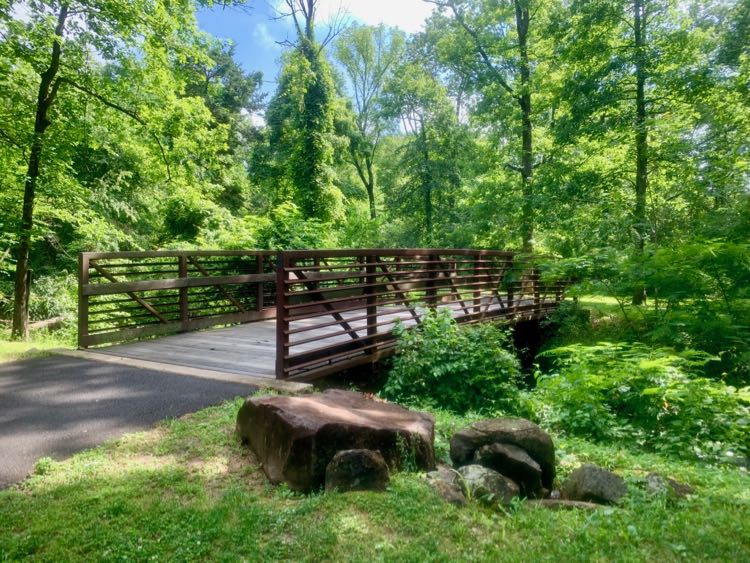
The southernmost end of the Sugarland Run trail was added in 2005 to connect the Washington and Old Dominion Bike Trail (W&OD) to the main SVT. This section is an easy stroll that crosses the stream 3 times over bridges. Since there are no fair weather crossings, this is the easiest section and is wheelchair accessible.
Park in the center at the corner of Elden Street and Herndon Parkway (you can enjoy a treat here, after your walk). Use the crosswalk to reach the trailhead at the southwest corner of the intersection. The trail enters the woods, then turns right over a bridge. Here you’ll have your first view of Sugarland Run.
The paved trail continues through the woods, crossing the stream over two more bridges. The trail is close to the stream in several sections, and borders developments in others. At the end, of the trail, a short uphill path leads to the W&OD bike trail.
You can turn back and return the way you came, or loop back on a dirt trail. For the loop, cross the wooden bridge and turn left on the dirt trail. Follow the dirt and gravel path as it winds behind an apartment complex then reconnects to the paved Sugarland Run trail. Avoid the dirt trail after heavy rains as it is likely be very muddy.
Sugarland Run South Trail from Elden Street to Weihle Ave
The middle section of the Sugarland Run hike is our favorite. Known as the South Trail, it includes a short boardwalk and several fun stream crossings. To begin the hike, park at the center on the corner of Elden Street and Herndon Parkway, and carefully cross the Parkway to the trailhead.
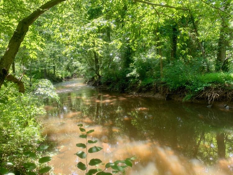
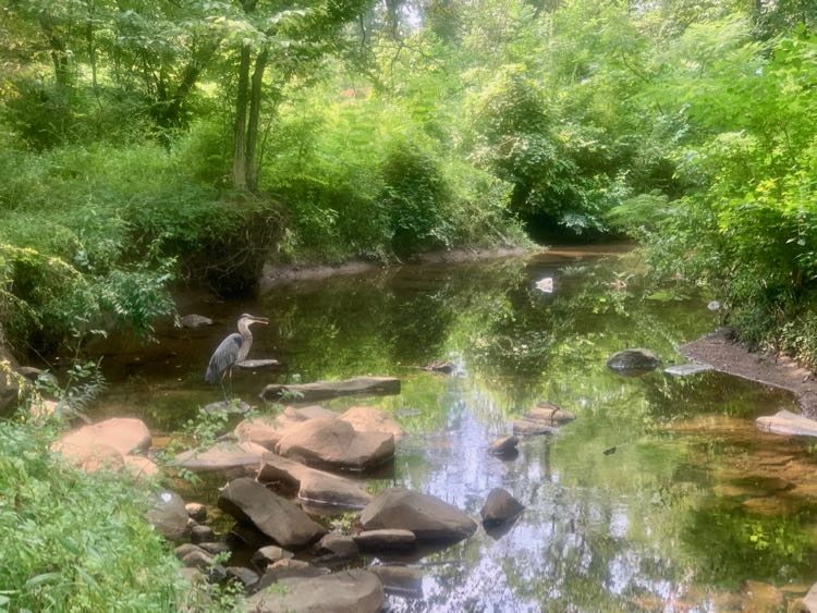
The trail immediately enters the woods then passes a nice playground and exercise area behind the Stuart Woods apartment complex. Next, you’ll cross a pretty bridge over Sugarland Run where we have seen Great Blue Heron in the stream.
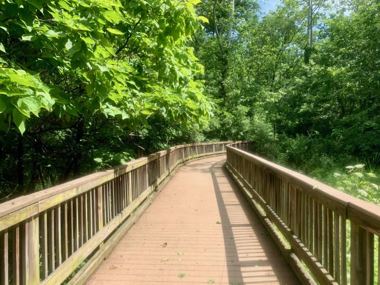
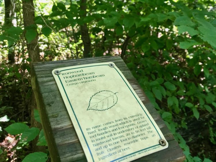
Just ahead is a short boardwalk over a marshy section of the trail. Watch for small signs that identify trees along the trail. The variety of trees is impressive, and big kids can read the descriptions aloud and teach the family new facts.
Keep an eye out for birds, dragonflies, and deer as you walk. On one hike, we saw a young Barred Owl near the boardwalk, a Great Blue Heron in the river, and a deer in the woods.
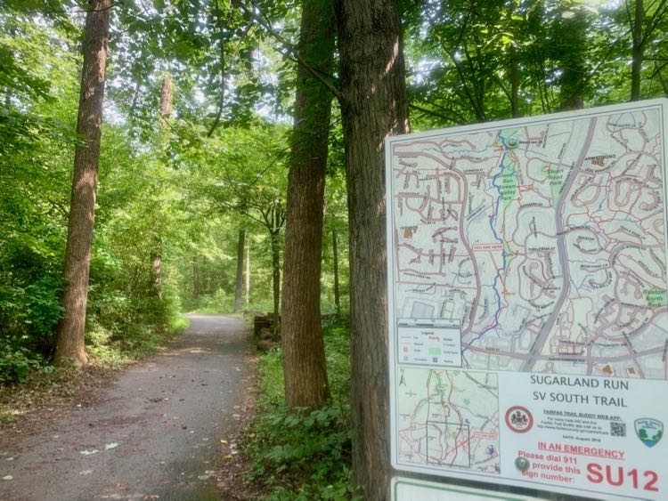
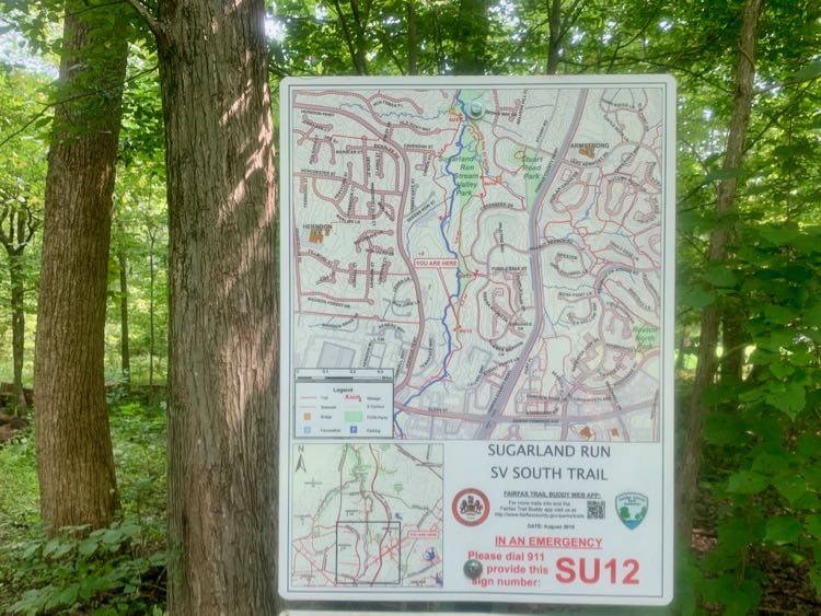
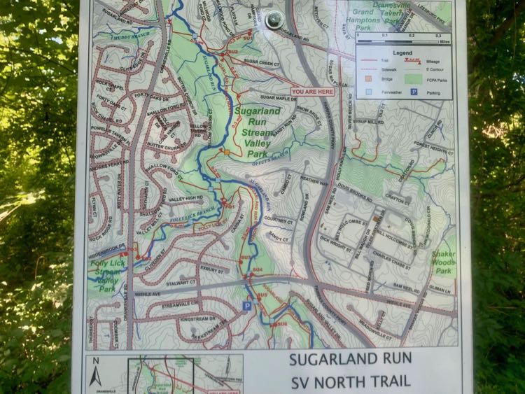
Soon the trail crosses the border into Reston, where you’ll see the first of several excellent trail map signs. There are many side trails that intersect with the main Sugarland Run hike, and these signs will help you stay on the main trail. In less than a mile you arrive at the first fair weather stream crossing over concrete columns.
Continue to follow the main trail as you enjoy a quiet walk in the woods. To create a partial loop (aka a lollipop), turn left at marker SU6, and follow the side trail back to SU8. The paved side trail passes close to a neighborhood before rejoining the main trail for your return trip.
Sugarland Run North Trail from Weihle to Dranesville
The northernmost section of the Sugarland Run hike is similar to the central section but shorter. You have the option of extending your walk with a side trip on the Folly Lick Stream Valley Trail. If you stick to Sugarland Run it’s about 3 miles out and back.
Park at the end of Sugarland Valley Drive, just south of Weihle, to begin the final section. The trail passes under Weihle Ave then crosses the stream on concrete columns.
If you’re hiking after heavy rains, we do not recommend this starting point. A day after Hurricane Isaias, the area under Weihle was a muddy mess and the first stream crossing was underwater. We ended up driving to Cassia Drive and starting our walk from there.
Whichever starting point you choose, you’ll enjoy another section of mostly shady, paved trail. There are 2 concrete pillar crossings and 1 bridge in the northern section. When you reach the end of the trail at Dranesville Road, return the way you came.
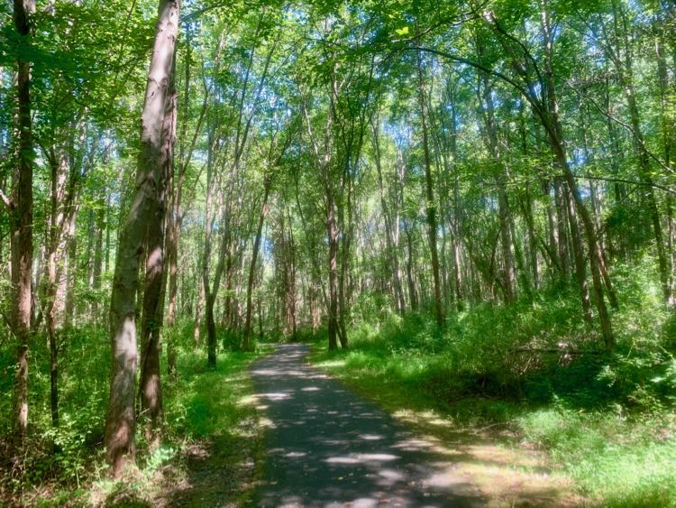
Whether you walk the full 4-mile Sugarland Run hike, or tackle a section at a time, you are sure to enjoy an easy woodland walk. The shady trail, frequent stream views and crossings, and easy access make this one of the most family-friendly trails in the Northern Virginia suburbs. Follow the link for a county map of Sugarland Run.
Places to Eat Near Sugarland Run in Reston and Herndon
After your hike, fuel up at one of many nearby restaurants in Reston or Herndon.
- The Bagel Cafe is one of our favorites for outdoor dining in Northern VA, and it is right at the start of the South Trail.
- Or you could pop into Duck Donuts for custom, fresh-made treats.
- Just around the corner, Tipicos Doña Gloria is on our list of tasty NoVA taco restaurants.
- A few blocks in the other direction is Thai Luang, one of the best Thai restaurants in the area.
- Or take a short drive to any of these 10 local restaurants in Reston.
More Family Friendly Places in Northern VA
Find more easy hikes in Northern Virginia and fun places to go with kids in these related articles:
- Wheelchair Accessible and Stroller Friendly Trails in Northern Virginia
- 6 Beautiful Boardwalk Hikes in Northern Virginia
- 21 Family Friendly Parks in Northern Virginia
- Glade Stream Valley Hike and Walker Nature Center in Reston Virginia
Follow Fun in Fairfax VA on Facebook | Pinterest | Instagram
Pin it for Later: