Updated on May 9, 2023 by Julie McCool
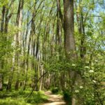
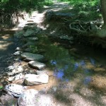
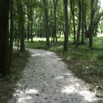
A shady trail is always welcome during a Virginia summer, and Fairfax County denizens are lucky that most of the Fairfax CCT (Cross County Trail) follows wooded stream beds through town and county parks. The only downside of all these shady streams is that they can become quite a mess after heavy rain. CCT segment 7 is a lovely suburban trail, but it’s particularly affected by rain because it includes several natural stream crossings.
CCT segment 7 is six miles long, from Lawyers Road in Reston (at the north end) to Oak Marr Park in Oakton, but we’ll show you how to complete it in roughly two-mile chunks.
CCT Segment 7.1: Lawyers to Vale Road
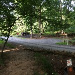
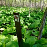
Judging from the overgrown flora along the path, this is the least traveled portion of CCT segment 7. This relative lack of activity may be because the unimproved stream crossing over Little Difficult Run is often partially or fully under water, unless we’ve had a good dry spell. When it is dry, you’ll find a nice wooded hike with a few steep sections and pretty horse farm views. We spied some interesting mushrooms—one that looked like a white golf ball waiting on its stalk for a woodland golfer, and another shockingly red. The trailhead for segment 7 is on Lawyer’s Road between Birdfoot Lane and Raccoon Ridge Court, near the crosswalk.


CCT Segment 7.2: Vale to Miller Heights Road
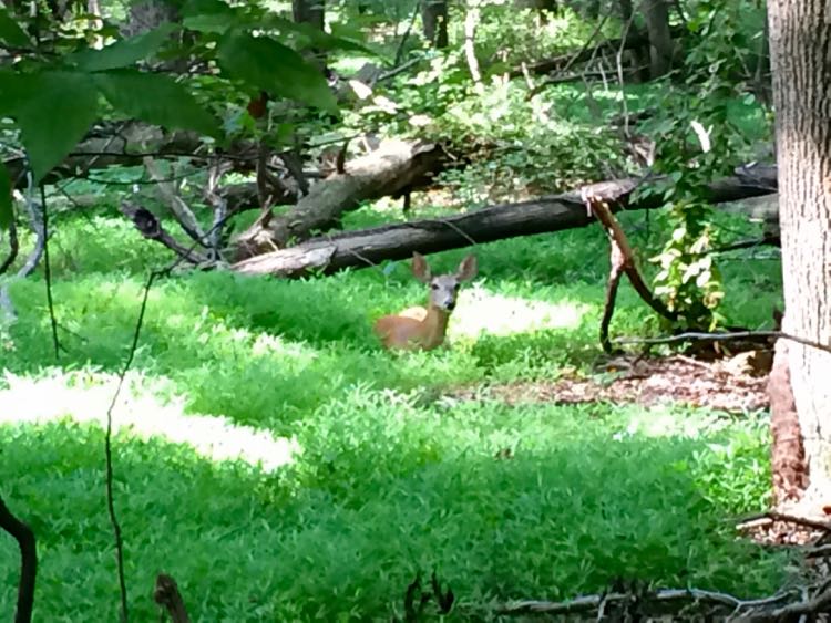
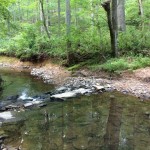
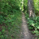
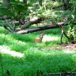
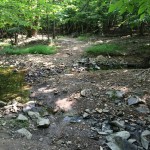
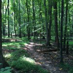
The segment between Vale Road and Miller Heights Road feels remote. The trail follows a nice dirt path along Difficult Run, with few hills and easy stream crossings. The trail is popular with joggers, hikers, and bikers, as it’s mostly level and almost entirely shady. On our last visit, we saw several pileated woodpeckers and a few deer, along with others enjoying the cooler than normal summer weather. There’s a small parking area on Vale Road, or you can park on Miller Heights Road and hike south to north.
CCT Segment 7.3: Miller Heights to Jermantown Road (Oak Marr Rec Center)
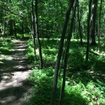
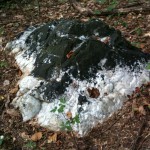
The southernmost portion of the trail begins on Miller Heights Road and enters the Oak Marr Parkland. You’ll encounter a somewhat rocky and hilly trail that is heavily shaded. We saw several deer on this portion of the trail, along with plenty of birds. Even though you’ll pass close to some houses, the trail is very pleasant and quiet. The first time we hiked this stretch, after a rain, we were surprised by the quartz rocks sticking up near the trail; they almost looked like snow.
GPS Trail Source identifies this piece of CCT segment 7 as a moderate single-track bike trail, and the tire tracks in muddy areas indicate it’s a popular one.
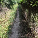

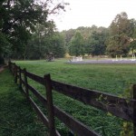
Once you reach the back of the Oak Marr Golf Course, the trail follows along a fence, passes over a bridge, and finally connects to a paved path out to Jermantown Road. (Watch out for flying balls!) If you’re hiking south to north, you could park at Oak Marr Rec Center and begin at the trailhead on Jermantown, southeast of the parking lot.
If you only have time for one part of CCT segment 7, focus on the stretch between Lawyers Road and Miller Heights. If you have youngsters along, we recommend you park at Vale then head north toward Lawyers Road. You’ll be on a shady, level path along the stream and past an active horse farm (a good spot to turn around).